A New Frontier in Digital Censorship?
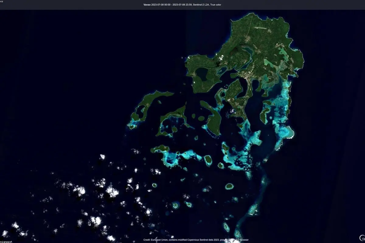
In the age of information, we have grown accustomed to the idea that the world is always being watched from above. From tracking environmental changes to monitoring human rights abuses in remote corners of the globe, high-resolution satellite imagery has become a pillar of modern accountability. But a recent shift in the accessibility of this data has sent ripples through the international community, raising difficult questions about who controls what we see from space.
Reports have surfaced indicating that a prominent satellite imagery provider has begun restricting high-definition views of Iranian territory. This move didn't happen in a vacuum; it follows significant pressure from the United States government, citing national security concerns. While the protection of sensitive military assets is a standard defense for such actions, the breadth of these restrictions is causing unease among those who rely on this data for independent analysis.
According to a detailed report by the BBC, the decision highlights a growing tension between private tech companies and state-level geopolitical strategies. As these companies become integral to the infrastructure of global intelligence, they find themselves caught in the crosshairs of diplomatic tug-of-wars.
The Rise and Fall of OSINT Transparency
To understand why this matters, one must look at the rise of Open-Source Intelligence, or OSINT. Over the last decade, a community of amateur and professional researchers has used commercially available satellite imagery to verify official claims. Whether it was identifying the buildup of troops on a border or verifying the aftermath of a missile strike, OSINT has acted as a decentralized check on government power.
When access to this data is throttled, that check disappears. For many experts in International affairs, the restriction of Iranian imagery represents a step backward for global transparency. If the public cannot verify events on the ground, the narrative is left entirely in the hands of state actors, who may have every incentive to shade the truth.
This isn't just about Iran. It’s about the precedent. If the U.S. can successfully pressure a provider to 'blind' a specific region today, what stops other nations from demanding similar concessions tomorrow? The fear is that we are moving toward a fragmented view of the Earth, where the quality of the 'eye in the sky' depends entirely on the political alliances of the moment.
The Security Dilemma
From Washington's perspective, the logic is clear. High-resolution imagery can be used by adversaries to plan attacks, assess the damage of previous strikes, or track the movement of sensitive equipment. In the context of the current tensions in the Middle East, the U.S. argues that providing such granular data to the public (and by extension, to Iran or its proxies) constitutes a direct threat to personnel and regional stability.
However, critics argue that 'shutter control'—a policy where the government restricts commercial satellite imagery during times of tension—is a blunt instrument in a digital world. Other providers, including those based in China or Russia, may not be subject to the same pressures, meaning the information might still be available to the very actors the U.S. is trying to block, while remaining hidden from journalists and NGOs.
The ethical debate boils down to a single question: Should a private corporation, which sells a global service, prioritize the security requests of a single nation over the transparency needs of the international community?
The Impact on Humanitarian and Academic Research
Beyond the world of military strategy, these restrictions have a chilling effect on humanitarian work. Satellite imagery is frequently used to monitor refugee movements, document the destruction of cultural heritage sites, and even track the effects of economic sanctions on civilian infrastructure. When a 'blind spot' is created over a country like Iran, the ability to document the human cost of conflict is severely diminished.
Academic researchers also find themselves at a loss. Much of the recent work on nuclear non-proliferation has relied on spotting changes in facility footprints through high-res imagery. Without it, the international community's ability to independently verify compliance with international treaties becomes much harder.
Looking Toward a Fragmented Future
The situation highlights a fundamental paradox of the digital age: we have more technology than ever before to see the truth, yet that technology is increasingly susceptible to the old-fashioned levers of political power. As the private space industry continues to grow, we can expect more of these collisions between corporate interests and national security mandates.
Ultimately, the restriction of Iran images serves as a wake-up call for the OSINT community and the public at large. It reminds us that our 'eyes in the sky' are not neutral observers. They are owned, operated, and regulated by entities that are part of a larger, often messy, geopolitical ecosystem. Ensuring that the world remains visible to everyone—not just those with the right security clearances—will likely be one of the great diplomatic challenges of the coming decade.