A Silent Crisis in the Undergrowth
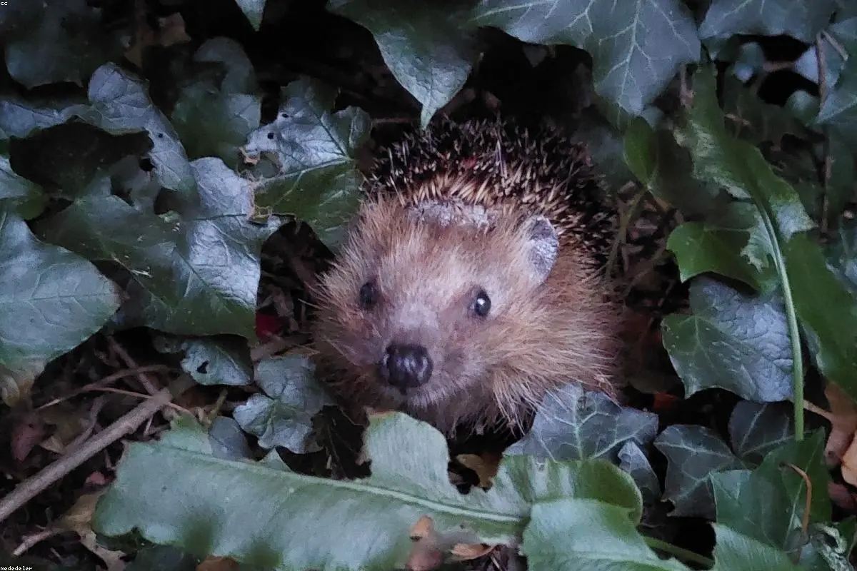
For generations, the sight of a hedgehog snuffling through the garden at dusk has been a staple of the British experience. However, these spiky icons are facing a quiet emergency. Over the last two decades, hedgehog populations in the United Kingdom have plummeted, with some rural areas seeing declines of up to 75%. The causes are a familiar cocktail of modern pressures: habitat loss, the fragmentation of green spaces, and the intensification of agriculture.
Monitoring these elusive, nocturnal creatures has historically been a challenge for conservationists. Traditional methods—relying on manual sightings or individual researchers—simply cannot cover the ground quickly enough to keep pace with the decline. To solve this, a coalition of wildlife charities is turning to the final frontier: space. By combining satellite data with advanced artificial intelligence, a new project aims to create the most comprehensive map of hedgehog activity ever produced.
The National Hedgehog Monitoring Programme
The initiative, known as the National Hedgehog Monitoring Programme (NHMP), represents a significant leap forward in conservation technology. Led by the People's Trust for Endangered Species (PTES) and the British Hedgehog Preservation Society (BHPS), the project is using a multi-layered approach to understand exactly where hedgehogs are thriving and where they are disappearing.
According to reports from the BBC, this is the first time such sophisticated tools have been deployed at a national scale for this species. The goal isn't just to count the animals, but to understand the environmental variables that influence their survival. By identifying which types of landscapes support healthy populations, researchers can provide actionable advice to developers and farmers on how to reconnect fragmented habitats.
The Role of AI: Sorting the Wheat from the Chaff
At the heart of this project is a massive network of camera traps placed in various habitats across the country. These motion-activated cameras capture millions of images, which would take a human researcher years to sort through. This is where artificial intelligence steps in. Using machine learning algorithms, the system can automatically filter out thousands of "empty" images triggered by a swaying branch or a passing bird, pinpointing exactly when and where a hedgehog has crossed the frame.
"AI allows us to process data at a speed and scale that was previously unimaginable," explains one project lead. This efficiency means that conservationists can get a near-real-time look at population trends. The AI isn't just looking for hedgehogs, either; it’s being trained to identify other species, providing a broader picture of the biodiversity in our parks and hedgerows.
From Orbit to the Earth
While the AI handles the ground-level data, satellite technology provides the overhead context. High-resolution satellite imagery is used to map the connectivity of the landscape. Hedgehogs are known for their ability to travel up to two kilometers in a single night in search of food and mates. When a new road or a garden fence blocks their path, the population becomes isolated and vulnerable.
By overlaying satellite maps with the AI-detected hedgehog hotspots, researchers can identify "pinch points" in the landscape. These are areas where a simple intervention—like a 13cm square hole in a fence, often called a 'hedgehog highway'—could reconnect two isolated populations. This marriage of macro and micro data is transforming the way we approach urban planning and land management.
Why Technology is the Key to Survival
The use of satellites and AI isn't just about being tech-savvy; it's about accuracy. In the past, conservation efforts were often reactive, occurring only after a species had reached a critical tipping point. The NHMP allows for a proactive stance. With the digital mapping provided by these technologies, scientists can predict which populations are at risk before the decline becomes irreversible.
Furthermore, this data-driven approach removes the guesswork from conservation funding. It ensures that resources are directed toward the specific regions and habitats where they will have the most significant impact. Whether it’s planting more hedgerows in a specific county or creating wildlife corridors in a new housing development, the decisions are backed by hard, digital evidence.
A Community Effort Powered by Innovation
Despite the high-tech nature of the project, the human element remains vital. Thousands of volunteers are involved in placing cameras and checking equipment. The project effectively bridges the gap between grassroots citizen science and cutting-edge technological innovation. It proves that technology, often blamed for the destruction of nature, can also be its most potent protector.
As we look toward the future, the lessons learned from the NHMP could be applied to other struggling species. The framework being built today—utilizing AI to process visual data and satellites to understand habitat connectivity—could become the standard for 21st-century wildlife management. For now, the focus remains on the humble hedgehog, ensuring that this cherished part of the British landscape doesn't become a memory, but remains a living, snuffling reality for generations to come.